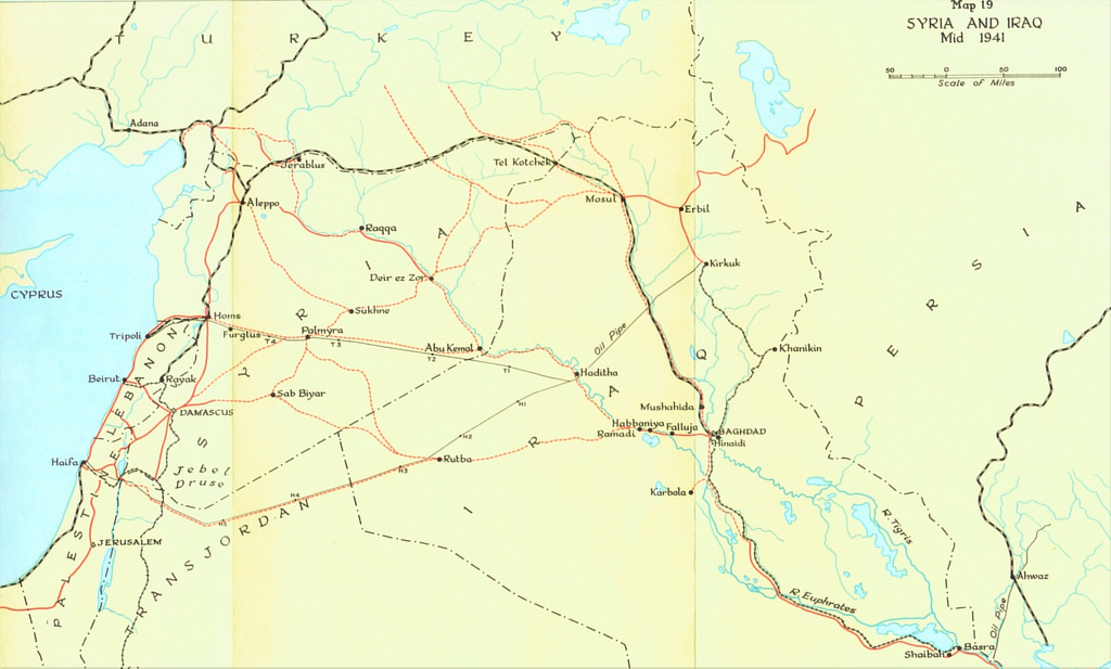
HISTORICAL RAILWAY IMAGES posted a photo:
The main railway lines of the Middle East, in a map from 1941
Starting with Turkey in the north, and progressing via Syria and Iraq, the map reaches as far east as Persia (today Iran), showing the historical railway link between Europe and Asia
Interestingly, there is no mention of the line between Tel Aviv and Jerusalem, which was completed already half a century before this map was published. Also missing is the short-lived British military line connecting Haifa with Beirut and Tripoli, in western Lebanon, completed in 1942 and abandoned only three years later